Ptolemaeus, Claudius (ca. 100-168) - Gastaldi, Giacomo (ca. 1500-1566). La geografia... Venice, Niccolò Bascarini for Giovanni Battista Pederzano, October 1547.


Ptolemaeus, Claudius (ca. 100-168) - Gastaldi, Giacomo (ca. 1500-1566). La geografia... Venice, Niccolò Bascarini for Giovanni Battista Pederzano, October 1547.
Ptolemaeus, Claudius (ca. 100-168) - Gastaldi, Giacomo (ca. 1500-1566).
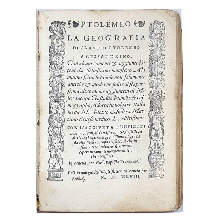
Ptolemeo. La geografia di Claudio Ptolemeo alessandrino, con alcuni comenti et aggiunte fattevi da Sebastiano Munstero Alamanno, con le tavole non solamente antiche et moderne solite di stamparsi, ma altre nuove aggiuntevi di messer Iacopo Gastaldo piamontese cosmographo, ridotta in volgare italiano da m. Pietro Andrea Mattiolo [...]
Venice, Niccolò Bascarini for Giovanni Battista Pederzano, October 1547.
The first pocket-size atlas and the first modern atlas to use engraved maps
Ptolemaeus, Claudius (ca. 100-168) - Gastaldi, Giacomo (ca. 1500-1566).
Ptolemeo. La geografia di Claudio Ptolemeo alessandrino, con alcuni comenti et aggiunte fattevi da Sebastiano Munstero Alamanno, con le tavole non solamente antiche et moderne solite di stamparsi, ma altre nuove aggiuntevi di messer Iacopo Gastaldo piamontese cosmographo, ridotta in volgare italiano da m. Pietro Andrea Mattiolo [...] Venice, Niccolò Bascarini for Giovanni Battista Pederzano, October 1547.
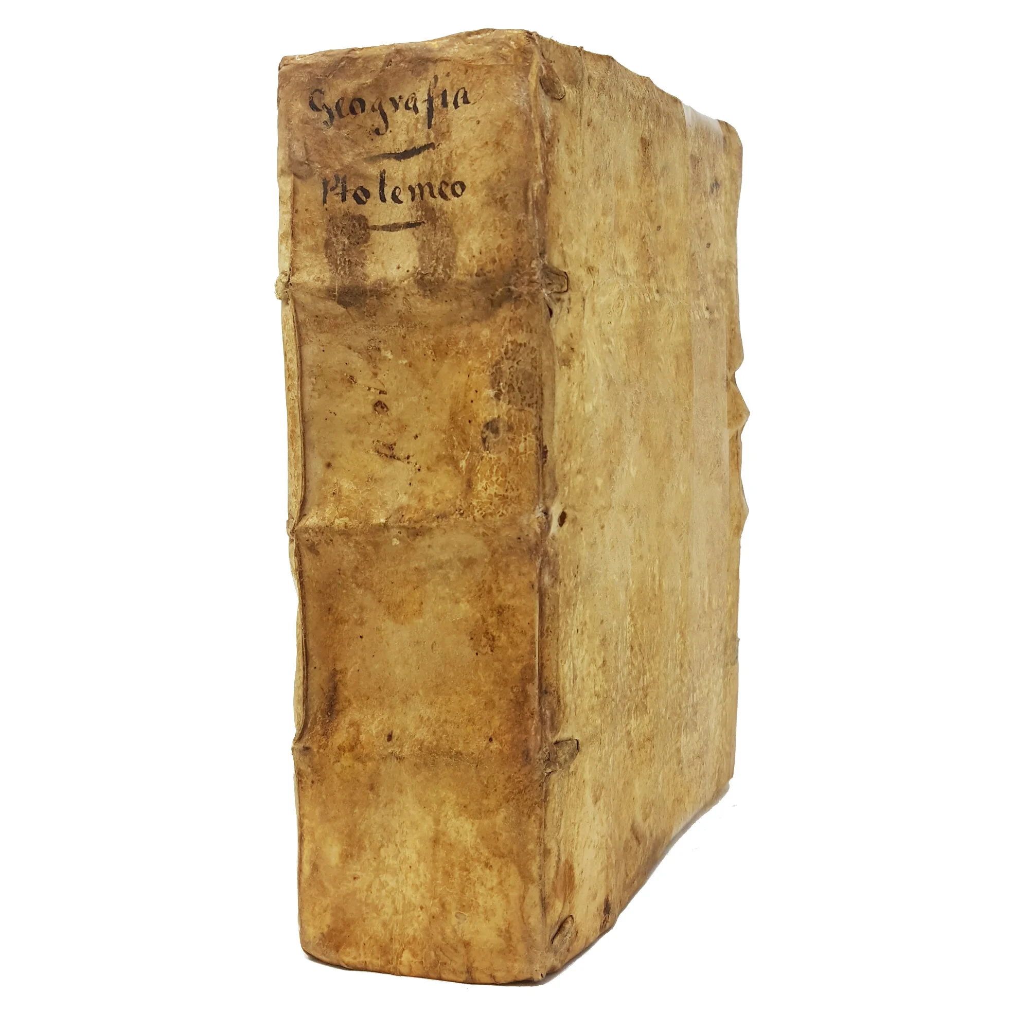
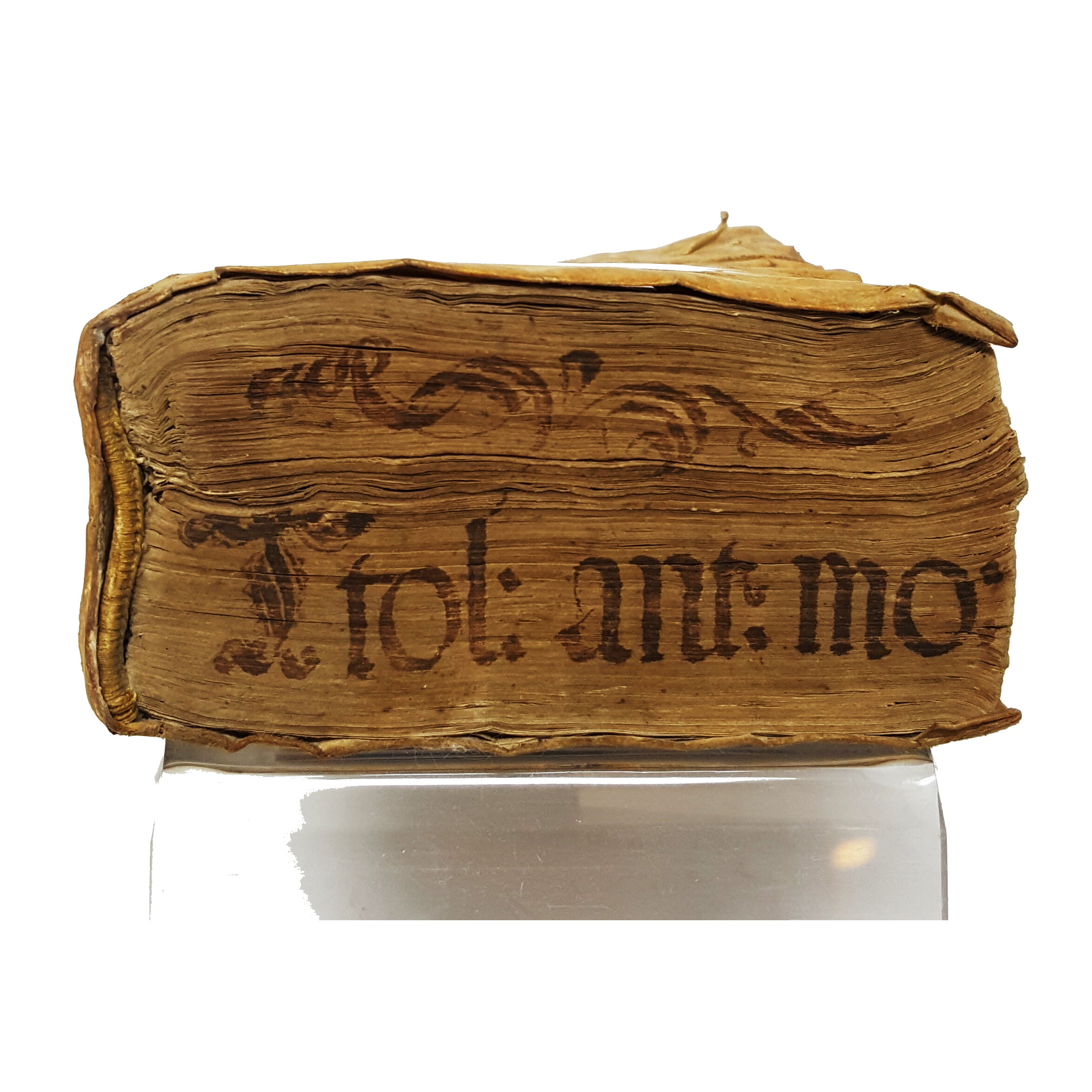
8° (173x110 mm). Collation: ☩8, A-Z8, AA-DD8, a-h8. [8], 214, [2] leaves. Complete with the last blank leaf. Italic and roman type. Title-page with two-sided woodcut border decorated with various figures. Printer’s device on fol. DD7r and last leaf verso. Full-page woodcut portrait of an astronomer, presumably Ptolemy, on fol. ☩ 2r; woodcut illustrations and diagrams in text. Sixty numbered and engraved double-page maps, with explanatory text on versos. Contemporary limp vellum, traces of ties. Inked title on the spine and on upper and lower edges. Minor losses to spine, covers slightly soiled. A very good, genuine copy. Paper loss to outer corners of plate 46 (map vii of Asia), affecting both the text and engraved map. Two quires slightly loose. On the verso of the rear flyleaf, a contemporary hand has written a passage concerning the sibyl Emeria, taken from the Ptolemy edition printed in Ulm in 1486.
Provenance: from the library of the Dionisi family, from Verona (engraved Dionisi bookplate and the shelf mark “DdVIII12” on the front pastedown).
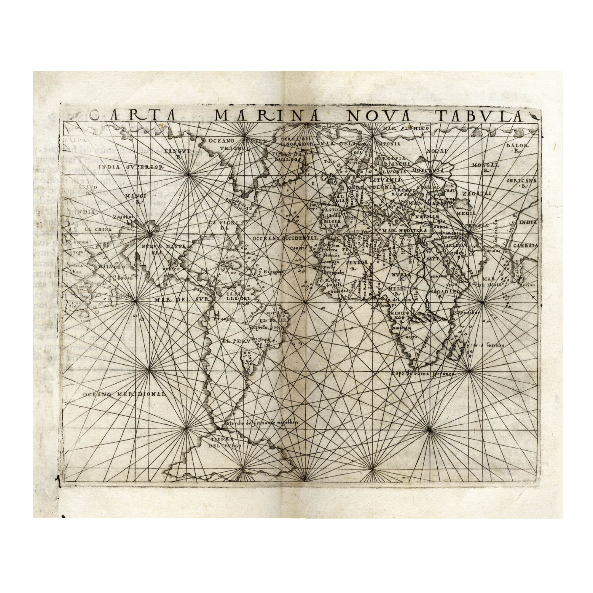
A genuine, first-edition copy, housed in its contemporary binding, of the first Italian translation of Ptolemy’s Geographia; the first pocket atlas, and the first modern atlas to use engraved maps, which were executed for this edition by Giacomo Gastaldi, the greatest Italian geographer and cartographer of the sixteenth century.
The Piedmontese mapmaker Gastaldi is considered a veritable pioneer in the use of copperplates in place of woodblocks. Although a number of engraved maps had been produced in the fifteenth century, the process had fallen into disuse in the first half of the sixteenth century until the appearance of this Venetian edition, which is credited with re-introducing copperplate engraving into the service of cartography.
Ptolemy’s Geographia was translated from Greek into Italian by the outstanding physician Pietro Andrea Mattioli (1501-1577), well known for his edition of Dioscorides. The text is supplemented with sixty fine double-page engravings by Gastaldi, thirty-four of which are modern, including the first modern regional maps of Italy ever produced, such as those of Piedmont, the Marca Trevisana, the Marca Anconetana, Sicily, and Sardinia. The descriptive texts printed on the versos are taken from the Ptolemy edited by Sebastian Münster, which appeared in Basel in 1540.
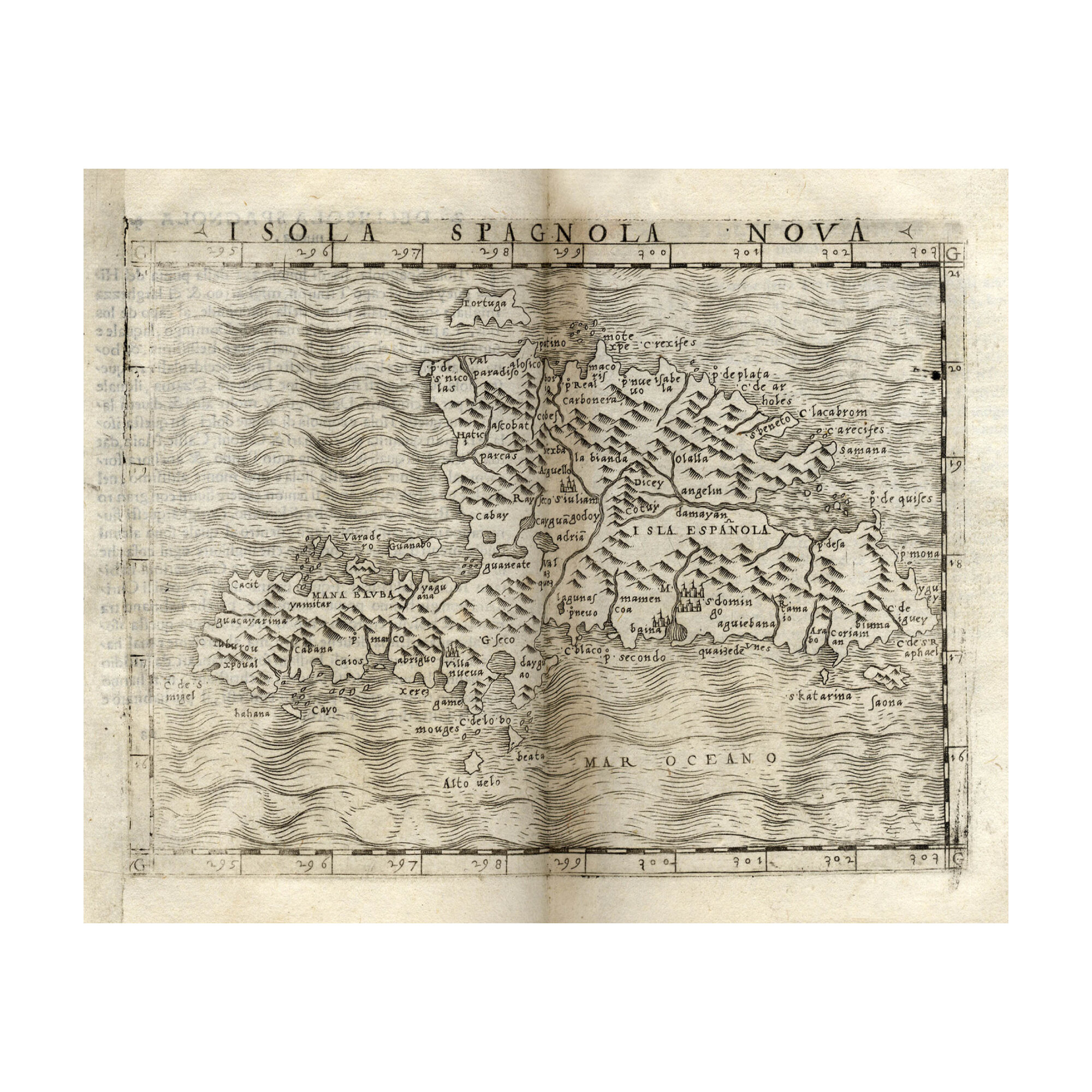
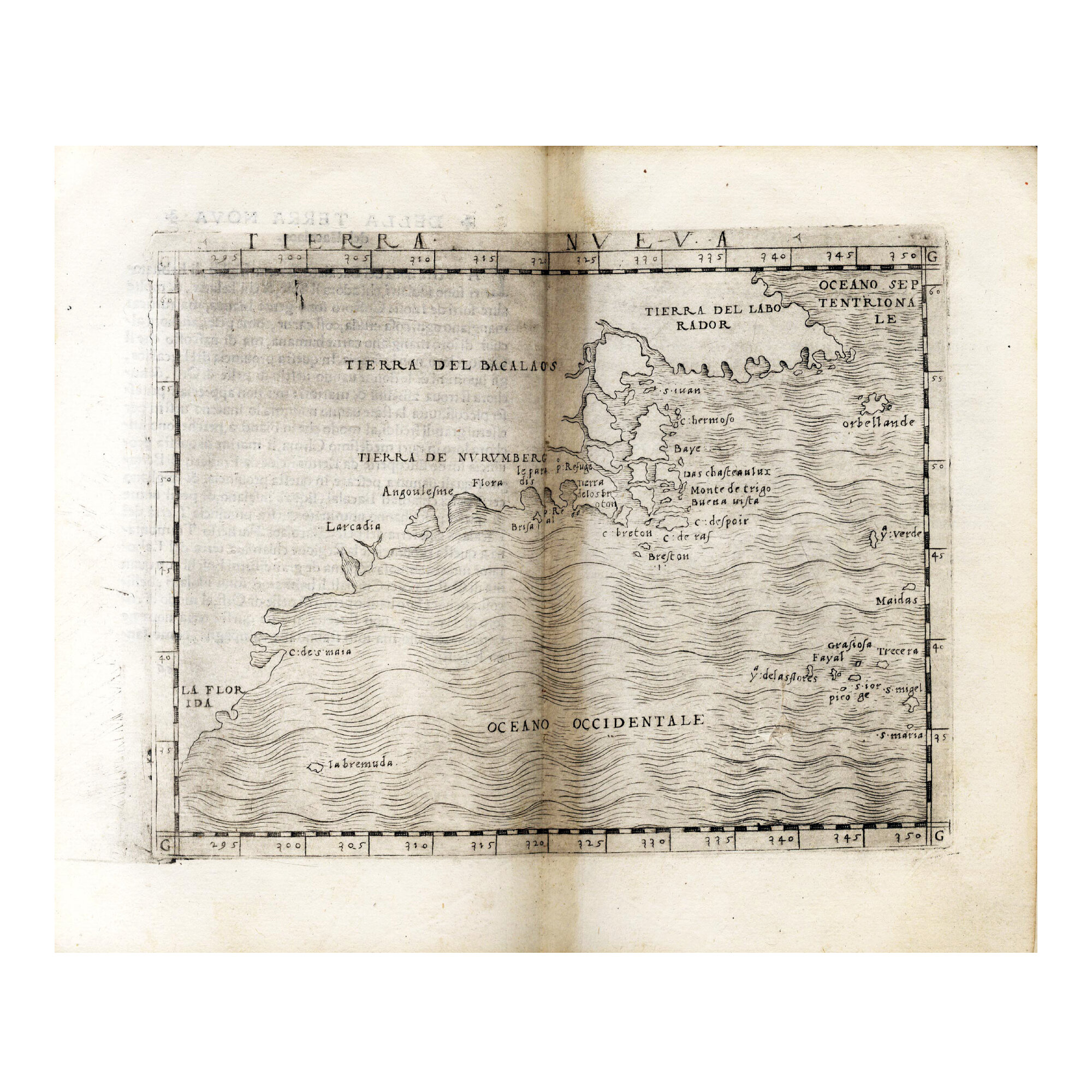
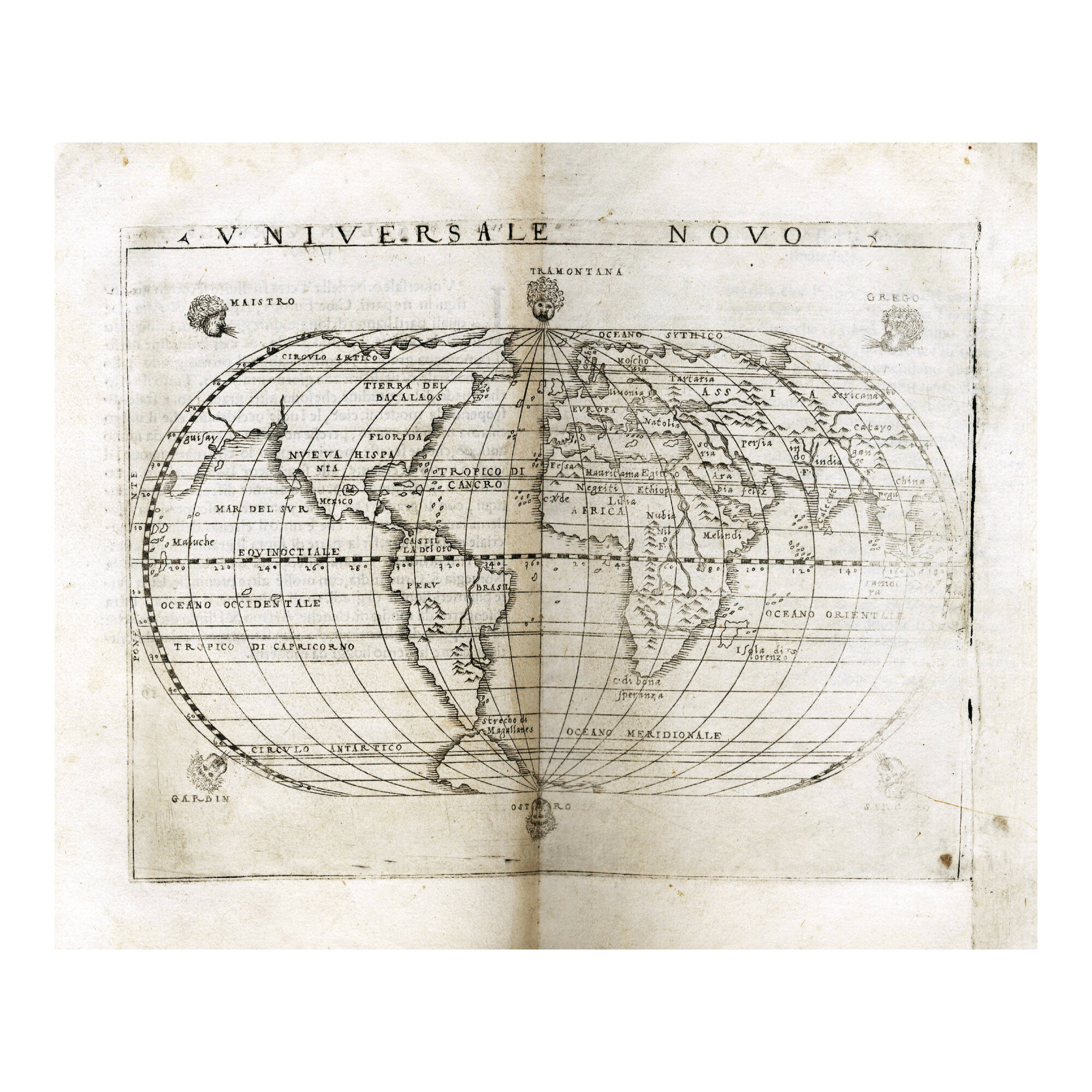
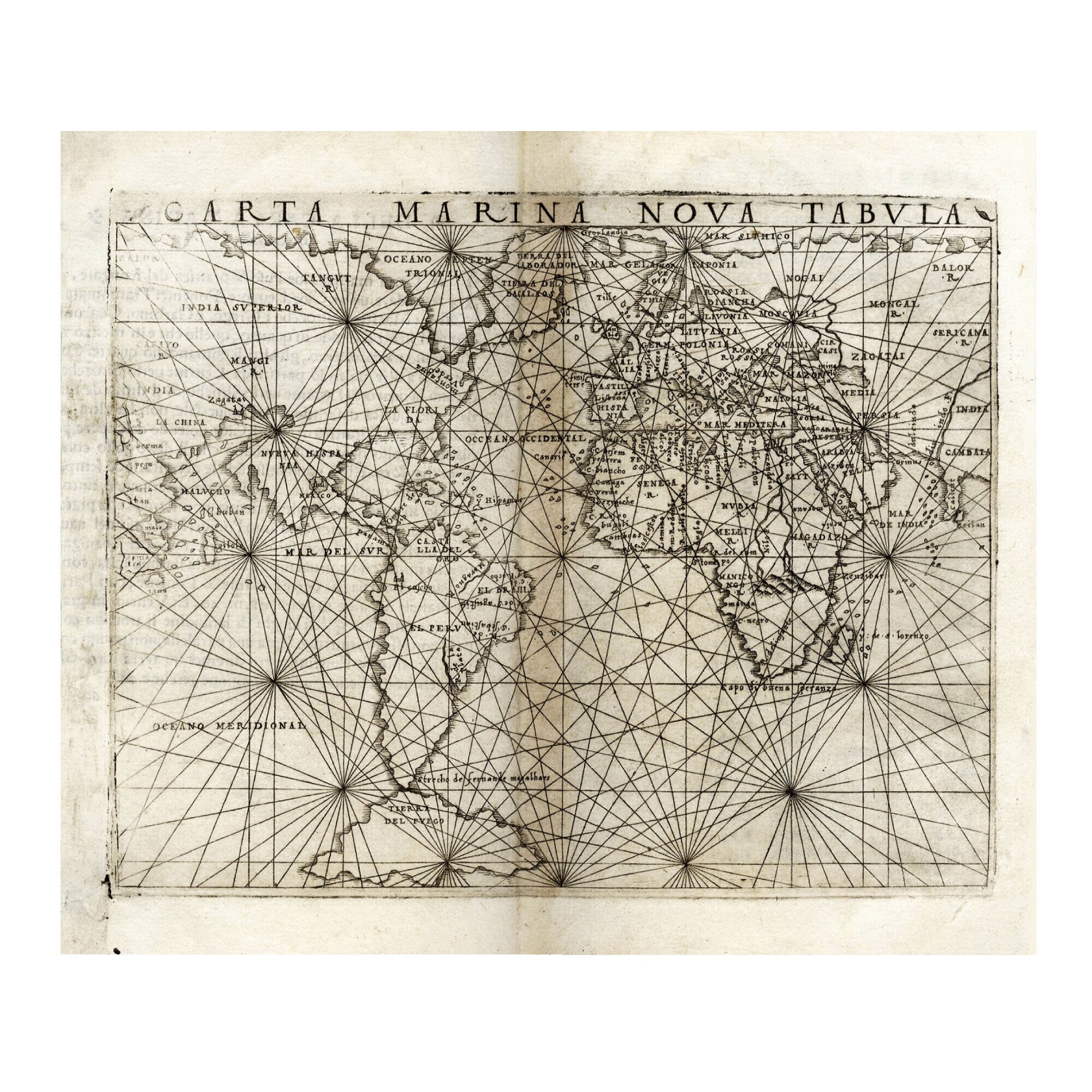
Gastaldi’s Ptolemy is also considered the first atlas of the New World, as it was the first to contain a series of maps of parts of North and South America, like the important map of western Hispaniola (now Dominican Republic) and the famous “Tierra Nueva” map of the North American coast from Florida to Labrador based on the most up-to-date information available at the time. The atlas also features a number of maps by or after Sebastian Münster in an attempt to include the most recent and advanced maps of certain regions. One of the two world maps in the atlas—the “Universale Novo”, published separately two years earlier—is considered one of the most important maps of the sixteenth century and was adopted by the Flemish cartographer Abraham Ortelius in his Theatrum Orbis Terrarum of 1570.
Adams P-2234; Mortimer Italian 404; Nordenskiöld 28; Philips 369; Riccardi i. 2, p. 137; Sabin 66502; Shirley 87; Tooley, p. 21; A. Codazzi, Le edizioni quattrocentesche e cinquecentesche della “Geografia” di Tolomeo, Milano 1950, pp. 88-90; L. C. Wroth, The Voyages of Giovanni da Verrazzano 1524-1528, New Haven, CT, 1970, pp. 202-203; R. Karrow, Mapmakers of the 16th Century and Their Maps, Chicago 1993, pp. 216-249; C. Fahy, The Venetian Ptolemy of 1548, D.V. Reidy (ed.), The Italian Book 1465-1800. Studies Presented to Dennis E. Rhodes on his 70th Birthday, London 1993, pp. 89-115; P. Gautier Dalché, La géographie de Ptolémée en Occident (IVe-XVI siècle), Turnhout 2009; S. Brendjes, “Giacomo Gastaldi’s Maps of Anatolia: The Evolution of a Shared Venetian Ottoman Cultural Space? A. Contadini - C. Norton (eds.), The Renaissance and the Ottoman World, Farnham, Surrey, 2013, pp. 123-141; L. Federzoni, “Testo e immagine. I codici manoscritti e le edizioni a stampa italiane della Geographia di Tolomeo”, I. Baumgärtner - P. Falchetta (eds.), Venezia e la nuova Oikumene. Cartografia del Quattrocento. Venedig und die neue Oikumene. Kartographie im 15. Jahrhundert, Rom-Venedig 2016, pp. 37-71; E. Horodowich, The Venetian Discovery of America: Geographic Imagination in the Age of Encounters, Cambridge 2018, esp. pp. 89-142.